![](/images/other/stat-length.png)
![Trail Walking Le Buisson - Randonnée du moulinet - Photo](https://media.geolcdn.com/t/1900/400/164d834d-9b41-4153-89c1-203c31fb85ed.jpg&format=pjpeg&maxdim=2)
Randonnée du moulinet
nicolasdresse
User
![Length](/images/other/stat-length.png)
Length
9.3 km
![Max alt](https://static1.geolcdn.com/siteimages/upload/files/1508320355ic_sort_altitude_max_24dp.png)
Max alt
1161 m
![Uphill gradient](https://static1.geolcdn.com/siteimages/upload/files/1508320355ic_sort_den_pos_24dp.png)
Uphill gradient
192 m
![Km-Effort](/images/other/stat-length.png)
Km-Effort
11.9 km
![Min alt](https://static1.geolcdn.com/siteimages/upload/files/1508320355ic_sort_altitude_min_24dp.png)
Min alt
1075 m
![Downhill gradient](https://static1.geolcdn.com/siteimages/upload/files/1508320355ic_sort_den_neg_24dp.png)
Downhill gradient
193 m
![Boucle](https://static1.geolcdn.com/siteimages/upload/files/16400158638029165_repeat_loop_refresh_sync_direction_icon.png)
Boucle
Yes
Creation date :
2020-08-13 10:46:24.0
Updated on :
2020-08-13 13:45:29.032
![Walking](https://static1.geolcdn.com/sitytour/trail-icons/101.png)
2h56
Difficulty : Medium
![Scan this QR Code to open this trail in the SityTrail application](https://capi.geolives.com/qq0zvz2zws4bq2lad0pu/sitytour/trails/2512480/qr.png?size=200)
FREE GPS app for hiking
About
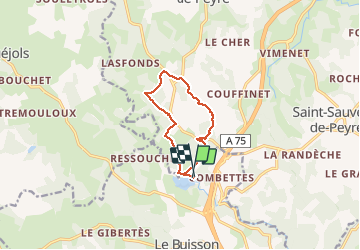
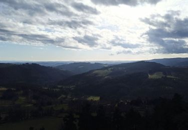
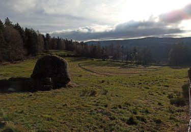
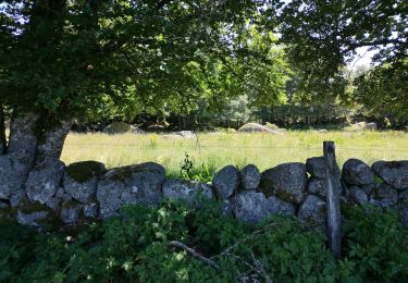
Trail Walking of 9.3 km to be discovered at Occitania, Lozère, Le Buisson. This trail is proposed by nicolasdresse.
Description
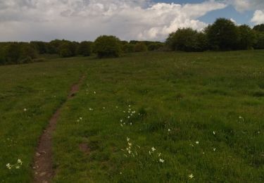
Départ depuis le lac du moulinet ( a côté des pédalos ). Randonnée serpentant entre les différents bourgs alentour et retour au lac. Randonnée sans réelle difficulté si ce n est la dernière cote qui est un peu velue . Rando faites avec enfants de 6 et 10 ans aguerris à cet exercice .
Positioning
Country:
France
Region :
Occitania
Department/Province :
Lozère
Municipality :
Le Buisson
Location:
Unknown
Start:(Dec)
Start:(UTM)
518682 ; 4943423 (31T) N.
Comments
Trails nearby
![Trail Walking Saint-Laurent-de-Muret - Tour des Monts d'Aubrac - De St Laurent de Muret au refuge des Rajas - Photo](https://media.geolcdn.com/t/375/260/ext.jpg?maxdim=2&url=https%3A%2F%2Fservices.sitytrail.com%2FGeolivesWS%2FDownloadMedia.ashx%3FTrailID%3D172691%26Media%3D14069_4.jpg)
![Walking Walking](https://static1.geolcdn.com/sitytour/trail-icons/101.png)
Tour des Monts d'Aubrac - De St Laurent de Muret au refuge des Rajas
Walking
Medium
(1)
Saint-Laurent-de-Muret,
Occitania,
Lozère,
France
![](/images/other/stat-length.png)
15 km | 21 km-effort
3h 30min
![](https://static1.geolcdn.com/siteimages/upload/files/16400158638029165_repeat_loop_refresh_sync_direction_icon.png)
No
![Trail Walking Saint-Laurent-de-Muret - st Laurent de Muret la Blatte - Photo](https://media.geolcdn.com/t/375/260/75837724-3e71-49e4-a463-a17a1c1852ed.jpg&format=jpg&maxdim=2)
![Walking Walking](https://static1.geolcdn.com/sitytour/trail-icons/101.png)
st Laurent de Muret la Blatte
Walking
Medium
Saint-Laurent-de-Muret,
Occitania,
Lozère,
France
![](/images/other/stat-length.png)
18.4 km | 25 km-effort
6h 24min
![](https://static1.geolcdn.com/siteimages/upload/files/16400158638029165_repeat_loop_refresh_sync_direction_icon.png)
Yes
![Trail Walking Le Buisson - Rando..Kac du Moulinet...Château de la Baume..14/05/2025 - Photo](https://media.geolcdn.com/t/375/260/68822122-8156-4c76-be8b-d91988115fcc.jpg&format=jpg&maxdim=2)
![Walking Walking](https://static1.geolcdn.com/sitytour/trail-icons/101.png)
Rando..Kac du Moulinet...Château de la Baume..14/05/2025
Walking
Difficult
Le Buisson,
Occitania,
Lozère,
France
![](/images/other/stat-length.png)
16.7 km | 21 km-effort
3h 34min
![](https://static1.geolcdn.com/siteimages/upload/files/16400158638029165_repeat_loop_refresh_sync_direction_icon.png)
Yes
![Trail Walking Saint-Laurent-de-Muret - zel st Laurent rajas - Photo](https://media.geolcdn.com/t/375/260/c5f59bb7-1373-40b8-8a16-41bc99e30222.jpg&format=jpg&maxdim=2)
![Walking Walking](https://static1.geolcdn.com/sitytour/trail-icons/101.png)
zel st Laurent rajas
Walking
Very easy
Saint-Laurent-de-Muret,
Occitania,
Lozère,
France
![](/images/other/stat-length.png)
18.9 km | 25 km-effort
8h 25min
![](https://static1.geolcdn.com/siteimages/upload/files/16400158638029165_repeat_loop_refresh_sync_direction_icon.png)
No
![Trail Walking Peyre en Aubrac - 28-12-22 roc de Peyre - Photo](https://media.geolcdn.com/t/375/260/0b22f3ca-3cd3-48f6-8f49-b34af22d0809.jpg&format=jpg&maxdim=2)
![Walking Walking](https://static1.geolcdn.com/sitytour/trail-icons/101.png)
28-12-22 roc de Peyre
Walking
Easy
Peyre en Aubrac,
Occitania,
Lozère,
France
![](/images/other/stat-length.png)
4.4 km | 5.8 km-effort
1h 17min
![](https://static1.geolcdn.com/siteimages/upload/files/16400158638029165_repeat_loop_refresh_sync_direction_icon.png)
Yes
![Trail Walking Peyre en Aubrac - 25-12-2022 lac du Moulinet - Photo](https://media.geolcdn.com/t/375/260/d5eb55c8-4ab6-406f-8f0c-155757ea8e79.jpg&format=jpg&maxdim=2)
![Walking Walking](https://static1.geolcdn.com/sitytour/trail-icons/101.png)
25-12-2022 lac du Moulinet
Walking
Easy
Peyre en Aubrac,
Occitania,
Lozère,
France
![](/images/other/stat-length.png)
7.6 km | 10.4 km-effort
2h 15min
![](https://static1.geolcdn.com/siteimages/upload/files/16400158638029165_repeat_loop_refresh_sync_direction_icon.png)
Yes
![Trail 4x4 Peyre en Aubrac - autour de Ste Colombe et Aumont-Aubrac - Photo](https://media.geolcdn.com/t/375/260/7c324dcb-be05-4abd-9ca8-a645b4128ec9.jpg&format=jpg&maxdim=2)
![4x4 4x4](https://static1.geolcdn.com/sitytour/trail-icons/403.png)
autour de Ste Colombe et Aumont-Aubrac
4x4
Very easy
Peyre en Aubrac,
Occitania,
Lozère,
France
![](/images/other/stat-length.png)
37 km | 46 km-effort
1h 41min
![](https://static1.geolcdn.com/siteimages/upload/files/16400158638029165_repeat_loop_refresh_sync_direction_icon.png)
Yes
![Trail Walking Saint-Laurent-de-Muret - Le truc de Crouzet - Photo](https://media.geolcdn.com/t/375/260/35b39e01-caee-4280-bcef-45f3d1fdd340.jpg&format=jpg&maxdim=2)
![Walking Walking](https://static1.geolcdn.com/sitytour/trail-icons/101.png)
Le truc de Crouzet
Walking
Very easy
Saint-Laurent-de-Muret,
Occitania,
Lozère,
France
![](/images/other/stat-length.png)
9.6 km | 12.8 km-effort
4h 11min
![](https://static1.geolcdn.com/siteimages/upload/files/16400158638029165_repeat_loop_refresh_sync_direction_icon.png)
Yes
![Trail Walking Saint-Laurent-de-Muret - Tour des Monts d'Aubrac 3 - Photo](https://media.geolcdn.com/t/375/260/ext.jpg?maxdim=2&url=https%3A%2F%2Fstatic1.geolcdn.com%2Fsiteimages%2Fupload%2Ffiles%2F1553511878bg_sport_marche.png)
![Walking Walking](https://static1.geolcdn.com/sitytour/trail-icons/101.png)
Tour des Monts d'Aubrac 3
Walking
Medium
Saint-Laurent-de-Muret,
Occitania,
Lozère,
France
![](/images/other/stat-length.png)
15.1 km | 21 km-effort
4h 28min
![](https://static1.geolcdn.com/siteimages/upload/files/16400158638029165_repeat_loop_refresh_sync_direction_icon.png)
No